 |
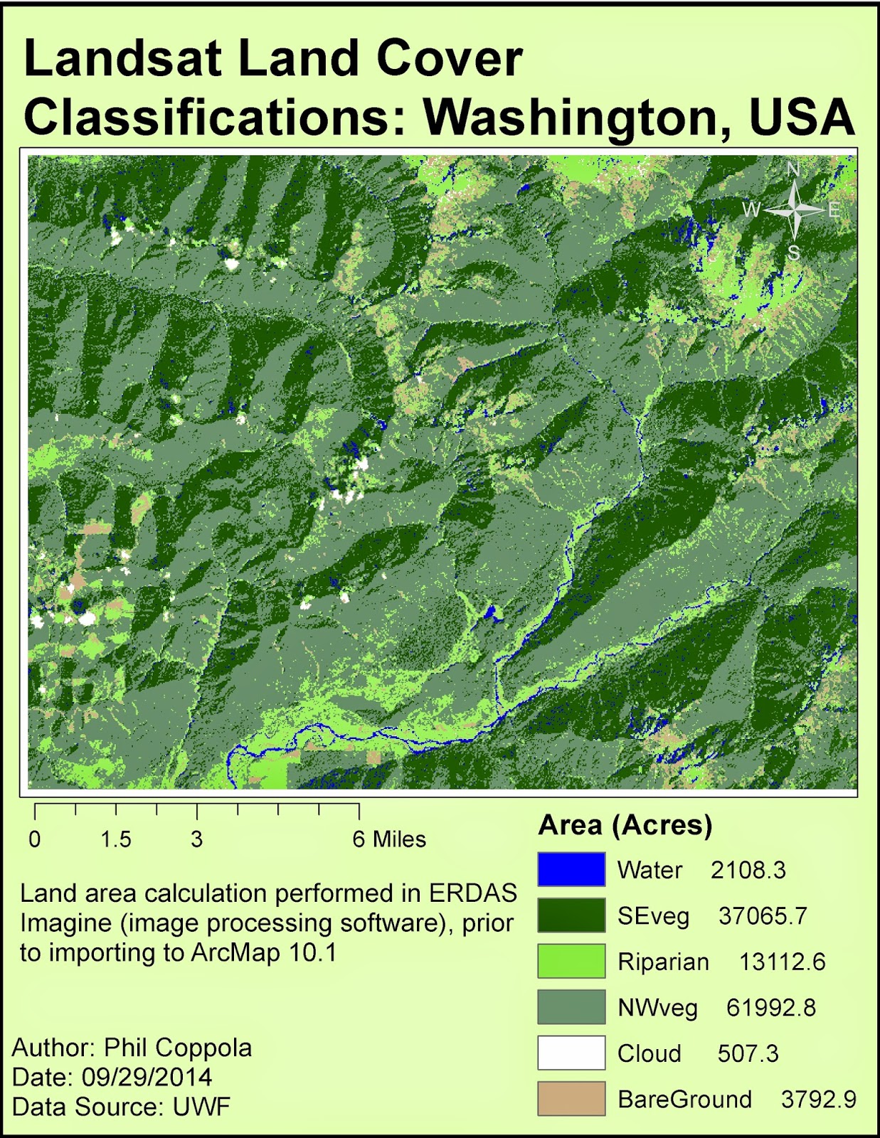
| Final map output of landcover generated from Landsat data first processed in ERDAS Imagine and ultimately in ArcMap. |
Tuesday, September 30, 2014
Module 5a Lab: Intro to ERDAS Imagine and Digital Data 1
Subscribe to:
Post Comments (Atom)
|
| Final map output of landcover generated from Landsat data first processed in ERDAS Imagine and ultimately in ArcMap. |
No comments:
Post a Comment